The Spring 2023 CPLN7200: Urban Design Studio, taught by Dr. Binita Mahato, worked with the Jan Dempsey Community Arts Center (JDCAC) of the Auburn Parks and Recreation Department, developing a Public Art Master Plan for the City of Auburn. Partners on the project include Auburn-Opelika Tourism, the Downtown Merchant Association and COA GIS Analyst, Stephanie Thompson.
The studio project followed a six-step process of exploring issues pertaining to public art in Auburn – sensing the project through site visits, observing and collecting data and information of the site and surrounding area, mapping and documenting people, places and phenomena; synthesizing the collected data; theorizing goals, objectives, mission, vision and values of the public art sites; analyzing the strengths, weaknesses, opportunities and development potential for sites; making rational designs, and implementation strategies through drawings, illustrations, plans and texts; communicating proposed plans through writing, illustrations, speaking and presenting. As part of the sensing phase, the studio created an inventory map of existing public art in the city and focuses on five focus areas – College St. Greenspace, Downtown Alleys, Gay St. Parking Lot, and Town Creek Park.
Students presented their final proposals were presented to the community partners, City ofAuburn officials, residents, business owners, faculty and staff from the Auburn University, and other stakeholders on Wednesday, April 26 at the Harris Center, Auburn, AL. The studio work will be published in a booklet format through Blurb.com. Interest people can access the booklet for free digitally or can purchase a hardcopy through the website.
The Fall 2022 CPLN 7600: Synthesis Studio developed conceptual plans for the Johnny Ray Rail-to-Trail for their capstone project taught by Dr. Sweta Byahut. This project was undertaken in collaboration with the Lee Russell Council of Governments (LRCOG), and coordinated by Daniel Wyatt and Benjamin McGarr from LRCOG.
The goal of Johnny Ray Rail-to-Trail project is to convert 37 miles of decommissioned rails lines to ADA-friendly, non-motorized; multi-use trails connecting Chambers, Lee, and Randolph counties in Alabama. This investment is expected to produce many social, economic, and health benefits in the surrounding rural communities. The project will support connectivity between schools, trails, parks, points of interests and jurisdictions in the region. It will provide long distance multi-use regional trail amenity in rural and small towns of Opelika, Lafayette, Five Points, and Roanoke in Alabama. It will not just encourage walking and cycling for recreation and transportation, but also result in improved public health, bolstered community quality of life and safety, and strengthened local economies.
Over the course of the semester, students have assured the LRCOG with the planning of the proposed trail for Opelika, Lafayette, Five Points, and Roanoke. Their objective was to develop a conceptual plan for the trail and surrounding area in each community, identifying a range of development proposals, and implementation strategies. At the end of the semester, students presented their final projects to the LRCOG and stakeholders from the communities including policy makers, engineers, planners, city and county officials, and others. The presentations were organized by the LRCOG, and provided community stakeholders an opportunity to see the ideas developed by students.

MLK Blvd Corridor Plan
The Spring 2021 CPLN 7200: Urban Design Studio, taught by Binita Mahato, worked on Auburn Martin Luther King Blvd (MLK) Corridor Urban Design Concept Plan focusing on the redevelopment of the corridor and its adjacent areas. Students worked closely with the Auburn Corridor Investment group (ACIG) following a six-step design process – sensing the project area through site visits, observing and collecting data and information of the site and surrounding area, mapping and documenting people, places, and phenomena; synthesizing the collected/ documented data; theorizing goals, objectives, mission, vision and values for the corridor; analyzing the strengths, weaknesses, opportunities, and threats, and spatial development potential of the corridor; making rational designs, and implementation strategies through drawings, illustrations, plans, and texts; and communicating proposed plans through writing, illustrations, speaking, and presenting.
Students presented their work in an informal poster session open house to the ACIG members, Dr. Olivia Cook and Mr. Erik Zellars, City of Auburn staff members, Vice President for University Outreach and Associate Provost Dr. Royrickers Cook, CLA Dean Dr. Joseph Aistrup, Department of Political Science Chair Dr. Paul Harris, and MCP faculty. Mr. Zellers complimented the MCP faculty and students on their outstanding works, saying that they are a tremendous asset to the community. He later informed the program that the Auburn Corridor Investment group (ACIG) is moving forward with the project on MLK, and that their design is directly influenced by the students' inputs.

Downtown Opelika Redevelopment
Spring 2019 Urban Design Studio, taught by Binita Mahato, worked on several small scale redevelopment projects around Downtown Opelika. The students started the studio with a field trip, led by the Planning Director of the City of Opelika – Matt Mosley. During the field trip, the students got exposed to the history of the area and potential sites and development opportunities. The studio then followed a six-step process to conceptualize and propose several redevelopment plans for Downtown Opelika. The processes include – 1) SENSING: observing and collecting data and information, mapping and documenting people, places, and phenomena; 2) SYNTHESIZING: organizing, structuring, and absorbing collected/ documented data; 3) ANALYSING: analyzing synthesized data to identify issues and problems; 4) THEORIZING: framing goals, objectives, mission, vision, and values; 5) MAKING: developing implementation strategies, plans and proposals; and 6) COMMUNICATING: communicate plans through writing, illustrations, speaking and presenting.
Along with the studio project, the students also acquired a basic knowledge base on urban design, such as Elements of Urban Design, their standards and measures, Measures of Urban Design; Urban Design Principles; and Urban Design Theories through a series of class lectures and readings. The students also learned design method skills like primary & secondary data collection and analysis; mapping and illustrating people, places, and phenomena.
The students worked in groups to identify project areas and scopes within downtown Opelika and formulated plans on various key issues concerning railroad reconnection, Court Square redevelopment, Industrialization prospects, public art opportunities, and main library improvements. The students presented their proposals as a combined Downtown Opelika Revitalization Plan to the City of Opelika at the end of the semester.

City of Opelika, Community Health Assessment
During Spring 2018 Synthesis Studio class, led by Dr. Rebecca Retzlaff, students worked with community members in Opelika, the Opelika Planning Department, and the Opelika Community of Hope Project consultants the Mobile Studio. Within the framework of community health, the successful completion of a synthesis project required students to pursue an extensive investigation and analysis of a specific and compelling planning problem, and then to fully develop and present findings and recommendations-from analysis through implementation–in verbal, graphic,written,and electronic form.
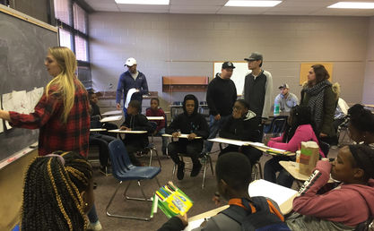
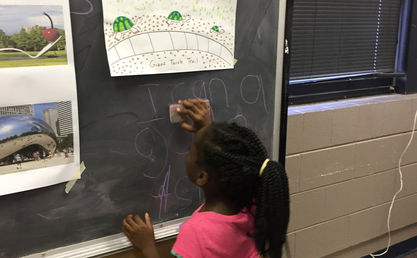
Two community outreach events were held by the students of for the youths participating in Ward 2 Academy Saturday school at the Opelika Learning Center, directed by Councilwomen Tiffany Gibson Pitts. There were four stations with various activities. The station were- story, block city, scavenger hunt and maps. The main target of those two outreach events as to gather data on what makes Opelika a great place to live for youth and what could be improved.
A list of topics was provided by Matt Mosely, Planning Director in Opelika, which was used by students to choose their project. Some of the topics were neighborhood commercial, downtown plan, community garden, parks and recreation plan, housing plan, transportation, natural hazards and resilience plan, and others.
Jay Howell received the 2018 Distinguished Leadership Award for a Planning Student from the American Planning Association - Alabama Chapter for "Reimagining 1st Avenue" project.

Bike Master Plan for the City of Auburn
This student project in Dr. Sweta Byahut's Sustainable Transportation Planning class was conducted in collaboration with the City of Auburn’s Bike Committee and the Planning Department. There was substantial preparatory work before the start of the semester to determine the scope of work, including meetings with city officials and the Auburn’s Bicycle Committee to determine the project focus. Ms. Brandy Ezelle (Traffic Engineer and member of Auburn’s Bike Committee) visited the classroom twice to provide guidance and feedback to students.
This project brought together sophisticated analysis and creative solutions in network planning, detailed design, engineering, and policy recommendations. In Phase 1, students analyzed case studies of communities around the country. In Phase 2, four groups investigated existing bicycling conditions using Bicycle Level of Service analysis for facilities using the Bicycle Compatibility Index (BCI) method, prepared GIS maps analyzing land uses, economic activities, demographic characteristics, street network, photo-documentation of existing facilities, as well as evaluated communications, marketing and bike safety education and enforcement strategies. In Phase 3, teams worked to identify strategies and policy recommendation to help Auburn advance to silver rating as a Bicycle Friendly Community. They clearly articulated planning goals and objectives, and developed the proposed network at local and regional scales, including improving network connectivity and identifying new/improved routes.
Students brought different elements together in a unified plan and produced a professional-quality report. At the end of the semester they made a presentation at the City Meeting Room to a full house, including several members of the Auburn Bicycle Committee, longtime residents, faculty, and city officials. They provided detailed insight and analysis, offering creative and viable options for an updated Bicycle Plan.
This class received the 2016 Distinguished Leadership Award for Planning Student/Team from the American Planning Association - Alabama Chapter.

Pop-up Library, Auburn
'The Nook' pop-up library design proposal was prepared during the spring semester of 2017, and reflects the work of the Master of Community Planning Program Urban Design Studio, under the direction of Dr. Yunmi Park.
The 'Pop-up Library In Auburn' project was a one day community event that focused on highlighting the value of public spaces for community engagement. This project was organized and executed by a collaboration comprised of the students from Urban Design Studio, Auburn Public Library and the Friends of the Auburn Public Library. The event was held during National Library Week, which provided the partners and opportunity to connect with the larger community and to increase the visibility of and accessibility to the library. It was located in the downtown, along Auburn's main street, where heavy pedestrian traffic takes place. The design was created in such a way that it could capture passers-by and invite them to stay and enjoy the event. Students were divided into different groups, such as a design group, construction group and outreach group. The students also registered many people for library cards and increased the awareness of the public library among residents.
This event received a great appreciation from Christopher S. Warren, Director of Auburn Public Library.

Opelika Road and Village Mall Redevelopment Project
Students in Dr. Sweta Byahut's Sustainable Transportation Planning class worked on an ongoing project for redevelopment of Opelika Road corridor in the City of Auburn. Auburn hired consultants for Opelika Road development, and students' work was complementary to the work being undertaken by the city. The project was therefore defined in consultation with the city planners and consultants. Student teams worked on separate sections of the Opelika Road. They documented the existing conditions, analyzed current policy, and carried out a bicycle and pedestrian Level of Service analysis using a performance measure point system, taking into consideration presence of sidewalks and crosswalks, conflict areas for pedestrians, signalization, bicycle facilities, curb cuts, etc. This was supplemented with photo-documentation and GIS analysis of the physical, land use, and demographic characteristics of the area. The students strategized proposals including design and policy guidelines for sidewalks, crosswalks, lighting, bicycle facilities, lane widths, side streets, transit, and land use. To develop alternatives and consider alternatives students undertook traffic engineering analysis using HCS+ (Highway Capacity Software) that automates recommendations of the Highway Capacity Manual using traffic counts, signal timing, and field data for optimal solutions. One team also proposed redevelopment of the Village Mall node and examined the environmental impact of the vast paved parking areas due to storm water runoff, pollution of nearby water bodies, and heat island effect. They proposed land use and design options such as form-based codes, mixed use and infill development to create more vibrant, walkable, and livable areas. Another team carried out a parking utilization survey documenting the occupancy of four lots in the mall area to determine an optimal land use policy for under-utilized/vacant land. All work was compiled in professional-quality reports that were shared with city officials. Students also got a chance to volunteered at two Public Meetings in the City Hall.
Asma Sheikh received the 2013 Distinguished Leadership Award for a Planning Student from the American Planning Association (Alabama Chapter) for the parking utilization study.

Comprehensive Plan, Loachapoka
The fall 2018 Synthesis Studio class, facilitated by Dr. Megan Heim-LaFrombois, worked with the town of Loachapoka in Alabama to create a comprehensive plan for the community. Loachapoka is located west of Auburn in Lee County, just 0.5 mile outside Auburn city limits. According to 2016 ACS Census data, the town has a population of 234, up from a population of 185 in 2011. Prior to white colonial settler occupation, the area was home to the Creek Native American Nation. It is now a small rural community that is feeling the pressure of outward expansion and sprawl from the Auburn area.
Students facilitated discussions with the Loachapoka community and assisted them in thinking about how they are going to plan for these changes and their future. In particular, the students collected and analyzed data from a number of sources and on a variety of different community aspects. Paramount to their work was engaging the community and its residents in this work in order to understand what their experiences and visions for Loachapoka are. On October 1, 2018, the class organized a community engagement event. The mayor, town council members, and over 30 community members participated in the event. Students also interviewed community stakeholders, conducted a community survey, and attended community events in order to solicit input from the community, which was then used to guide their resulting comprehensive plans.
Students, working in groups, produced three different comprehensive plans and accompanying posters. These were presented on November 27, 2018, and given to the Loachapoka Town Council.


